1/15


Trainsity Manila LRT MRT PNR
1K+下载次数
10.5MB大小
2.10.0(12-02-2025)最新版本
详情评价版本信息
1/15

Trainsity Manila LRT MRT PNR介绍
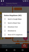
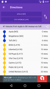
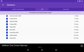
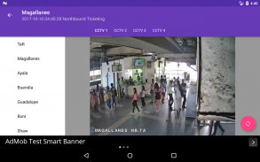
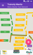
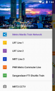
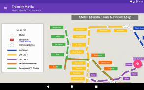
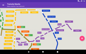
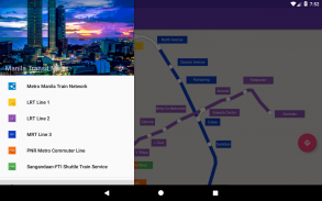
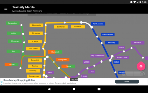
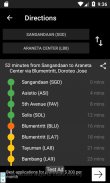
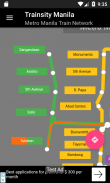
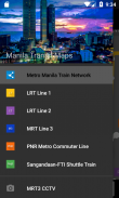
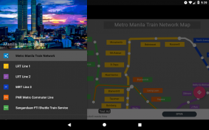
使用我们应用程序的高分辨率矢量地图,轻松浏览马尼拉及全球其他公共火车网络。选择并下载您所需的地图,享受详细的缩放级别,而无需占用过多存储空间。查看火车线路时刻表和班次,以及车站首末班车(适用于包含时刻表的地图)。所有功能均可离线使用,无需网络连接。
使用我们直观高效的应用程序,探索无缝探索火车网络的方式。
目前可用的地图有:
- 新加坡
- 吉隆坡,马来西亚
- 札幌,日本
- 累西腓,巴西
- 巴西利亚,巴西
- 温哥华,加拿大
- 香港,中国
- 曼谷,泰国
- 马尼拉,菲律宾
- 大阪,日本
- 阿姆斯特丹,荷兰
- 河内,越南
- 乌得勒支,荷兰
- 雅加达,印度尼西亚
- 里约热内卢,巴西
- 巨港,印度尼西亚
- 埃德蒙顿,加拿大
- 卡尔加里,加拿大
- 悉尼,澳大利亚
- 福冈,日本
- 巴黎,法国
- 福塔莱萨,巴西
- 蒙特利尔,加拿大
- 罗马,意大利
- 多伦多,加拿大
- 里昂,法国
- 阿尔及尔,阿尔及利亚
- 圣保罗,巴西
- 珀斯,澳大利亚
- 胡志明市,越南
- 米兰,意大利
- 纽伦堡,德国
- 哥本哈根,丹麦
- 索布拉尔,巴西
- 纳塔尔,巴西
支持的语言应用程序:
英语、马来语、印尼语、中文、葡萄牙语、日语、泰米尔语、泰语、西班牙语、荷兰语、越南语、法语、意大利语、阿拉伯语、德语、丹麦语
Trainsity Manila LRT MRT PNR - 版本2.10.0
(12-02-2025)新特性Redesigned Select Stations activity for better usability.
Trainsity Manila LRT MRT PNR - APK信息
APK版本: 2.10.0程序包: com.dom925.trainsity.manila名称: Trainsity Manila LRT MRT PNR大小: 10.5 MB下载次数: 9版本: 2.10.0发布日期: 2025-05-27 11:27:01最小屏幕: SMALL支持的CPU:
程序包ID: com.dom925.trainsity.manilaSHA1签名: E5:9D:19:FD:8D:A4:3A:AF:CD:14:FF:7A:C8:C2:21:93:15:E5:49:67开发商 (CN): Dominic Chin组织 (O): 本地 (L): 国家/地区 (C): SG州/市 (ST): 程序包ID: com.dom925.trainsity.manilaSHA1签名: E5:9D:19:FD:8D:A4:3A:AF:CD:14:FF:7A:C8:C2:21:93:15:E5:49:67开发商 (CN): Dominic Chin组织 (O): 本地 (L): 国家/地区 (C): SG州/市 (ST):
Trainsity Manila LRT MRT PNR的最新版本
2.10.0
12/2/20259 下载次数10.5 MB 大小
其他版本
2.9.1
22/1/20259 下载次数10.5 MB 大小
2.5.100
20/10/20229 下载次数3.5 MB 大小


